Drafts for a print of Hong Kong's 214 islands. Tap a poster for a large image; the PDFs are vector. Back to the map
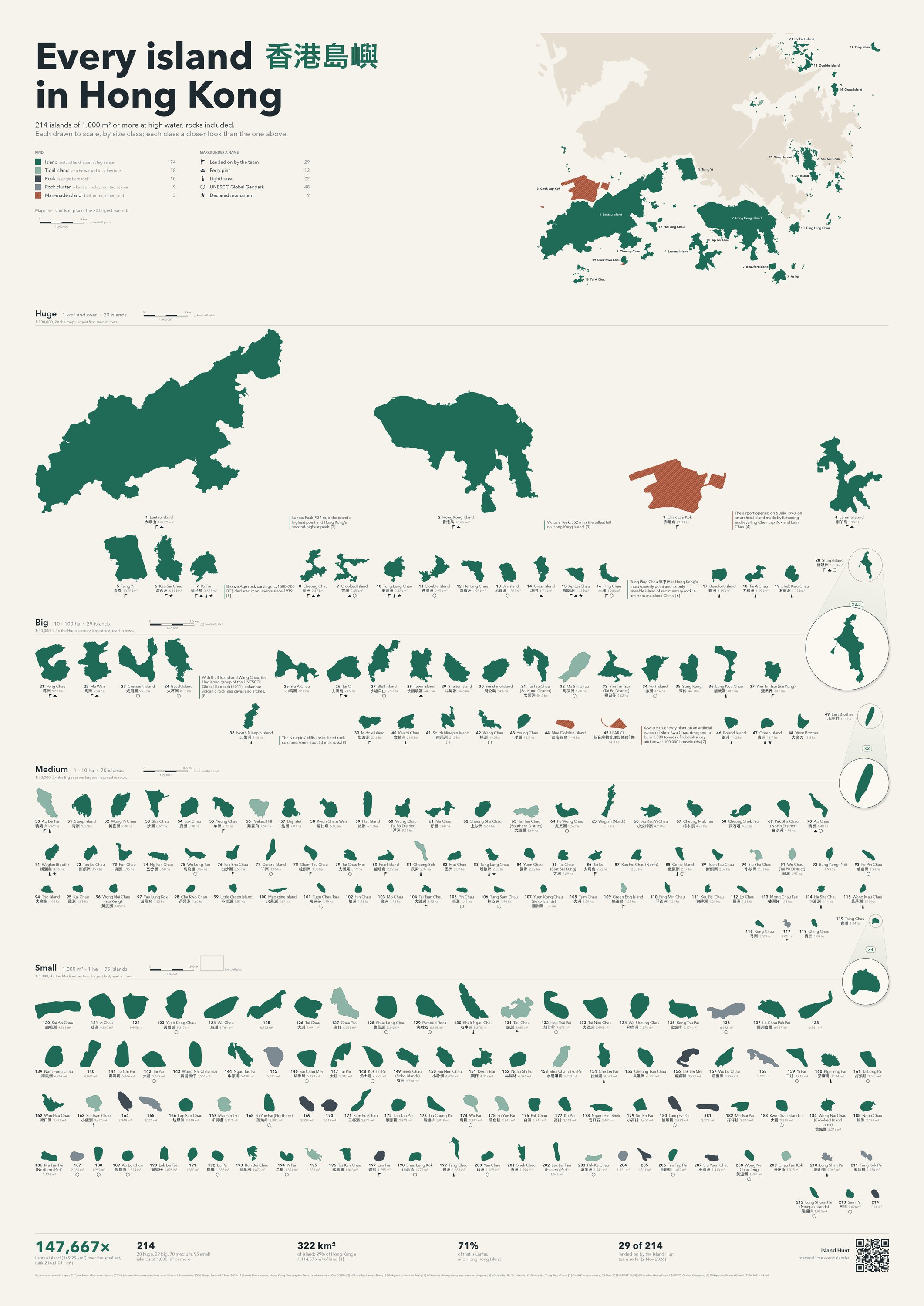
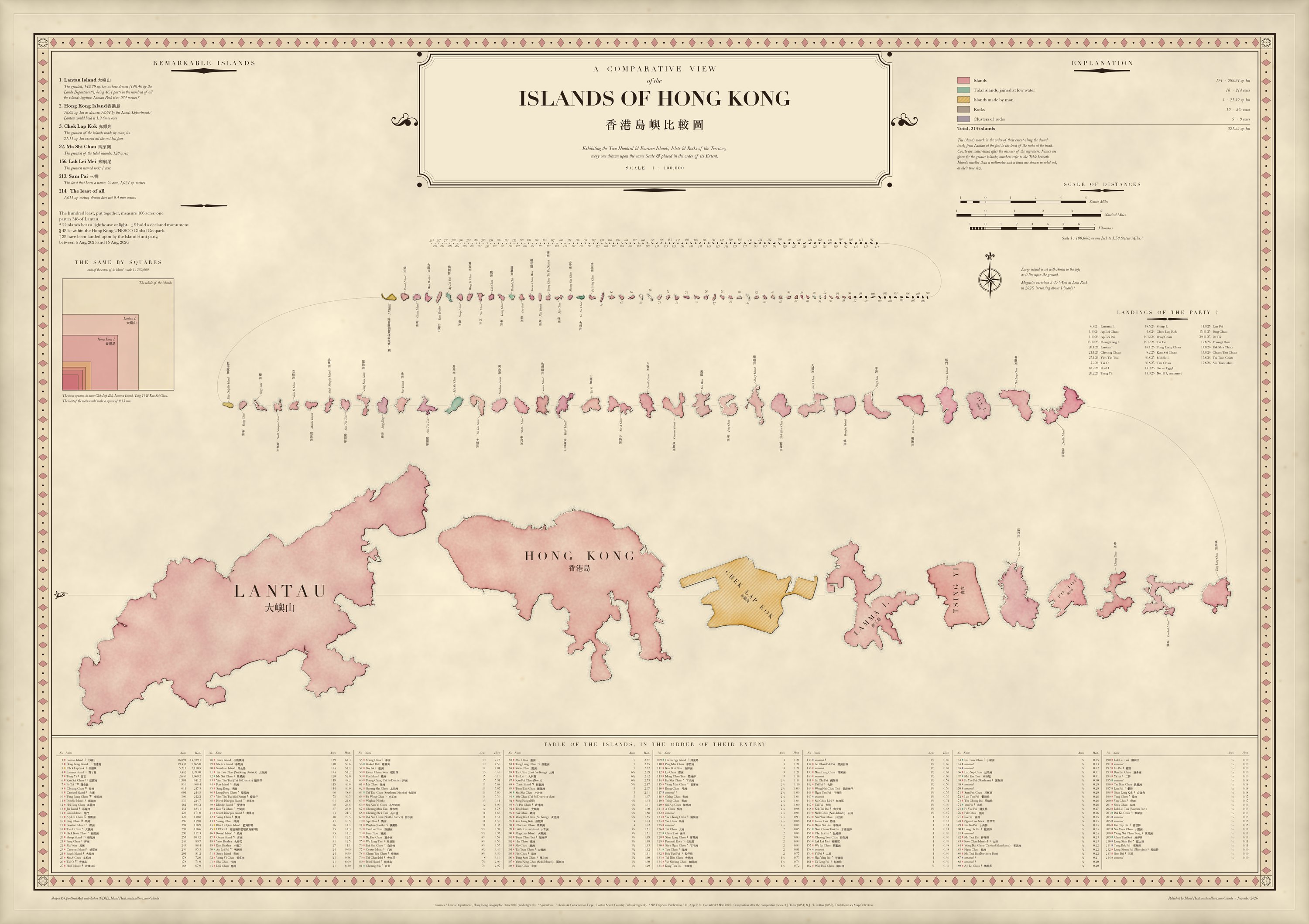
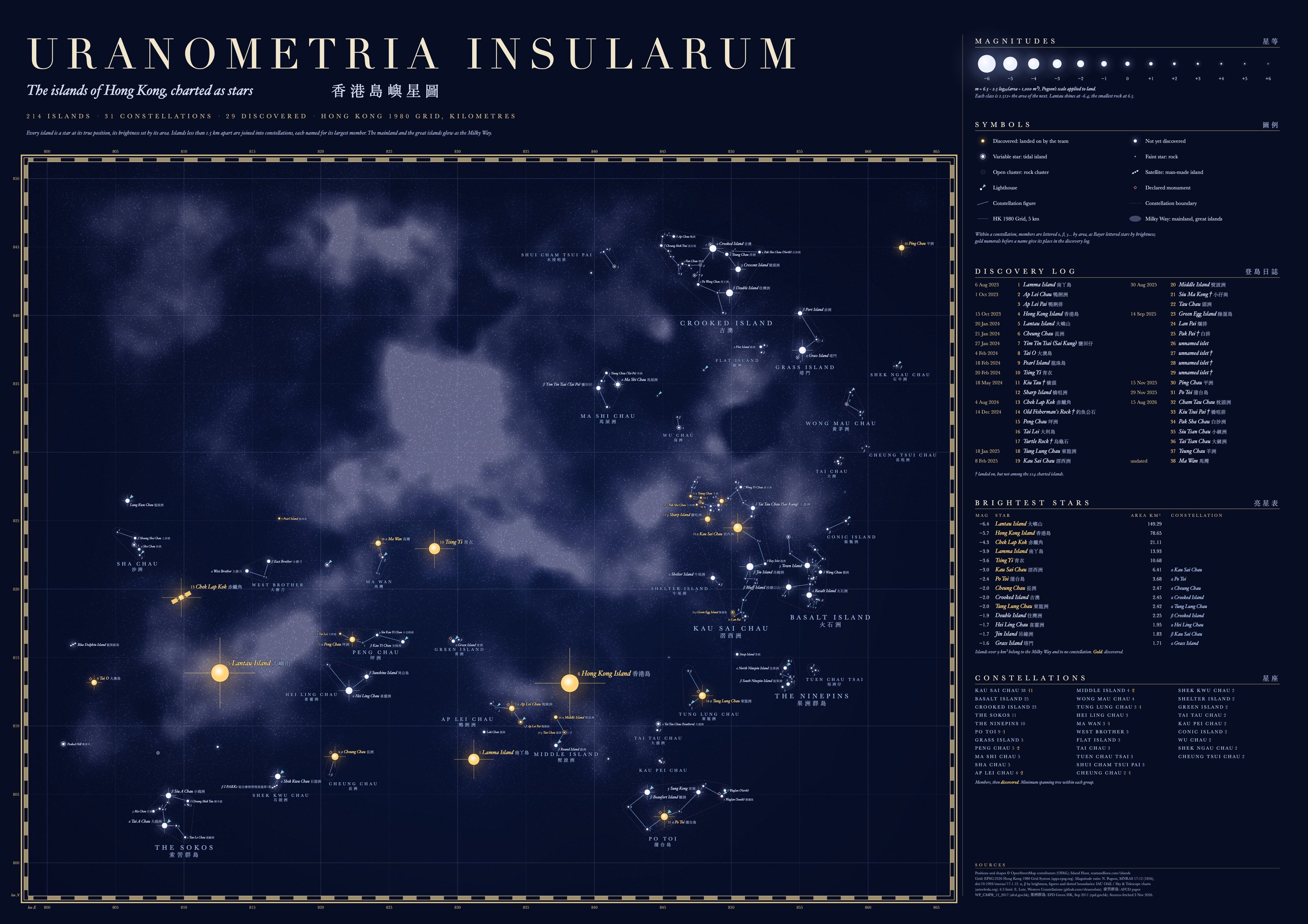
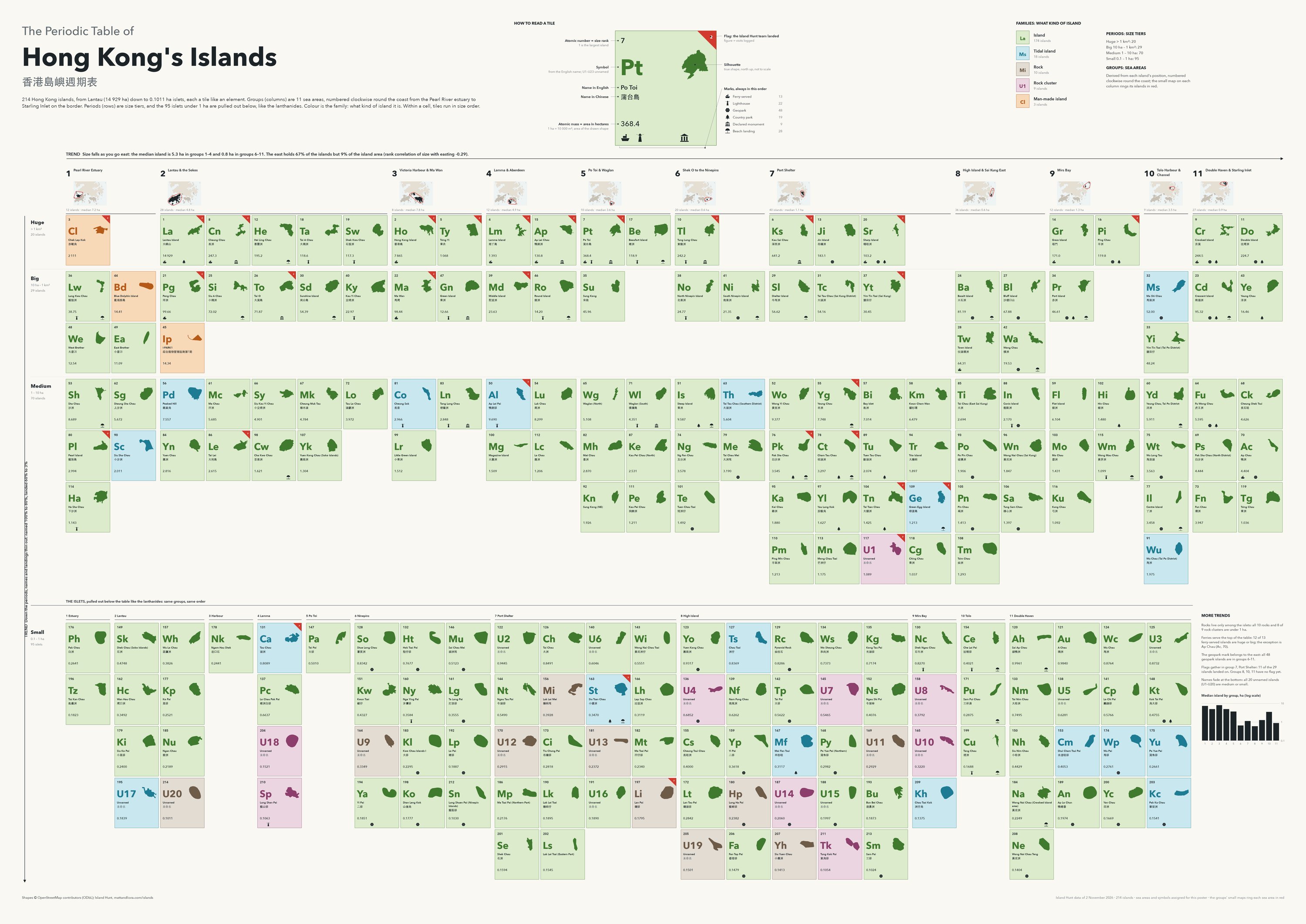
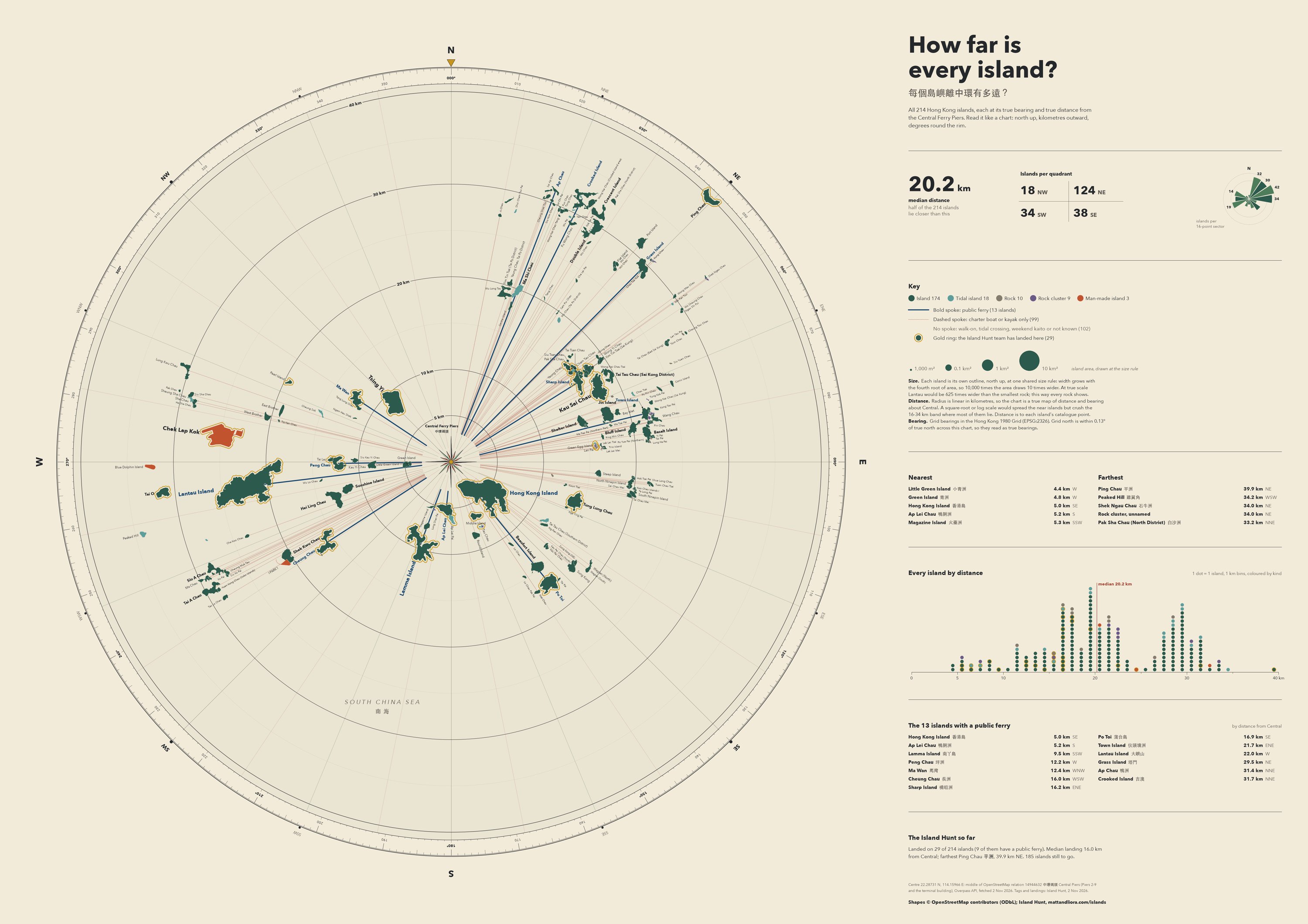
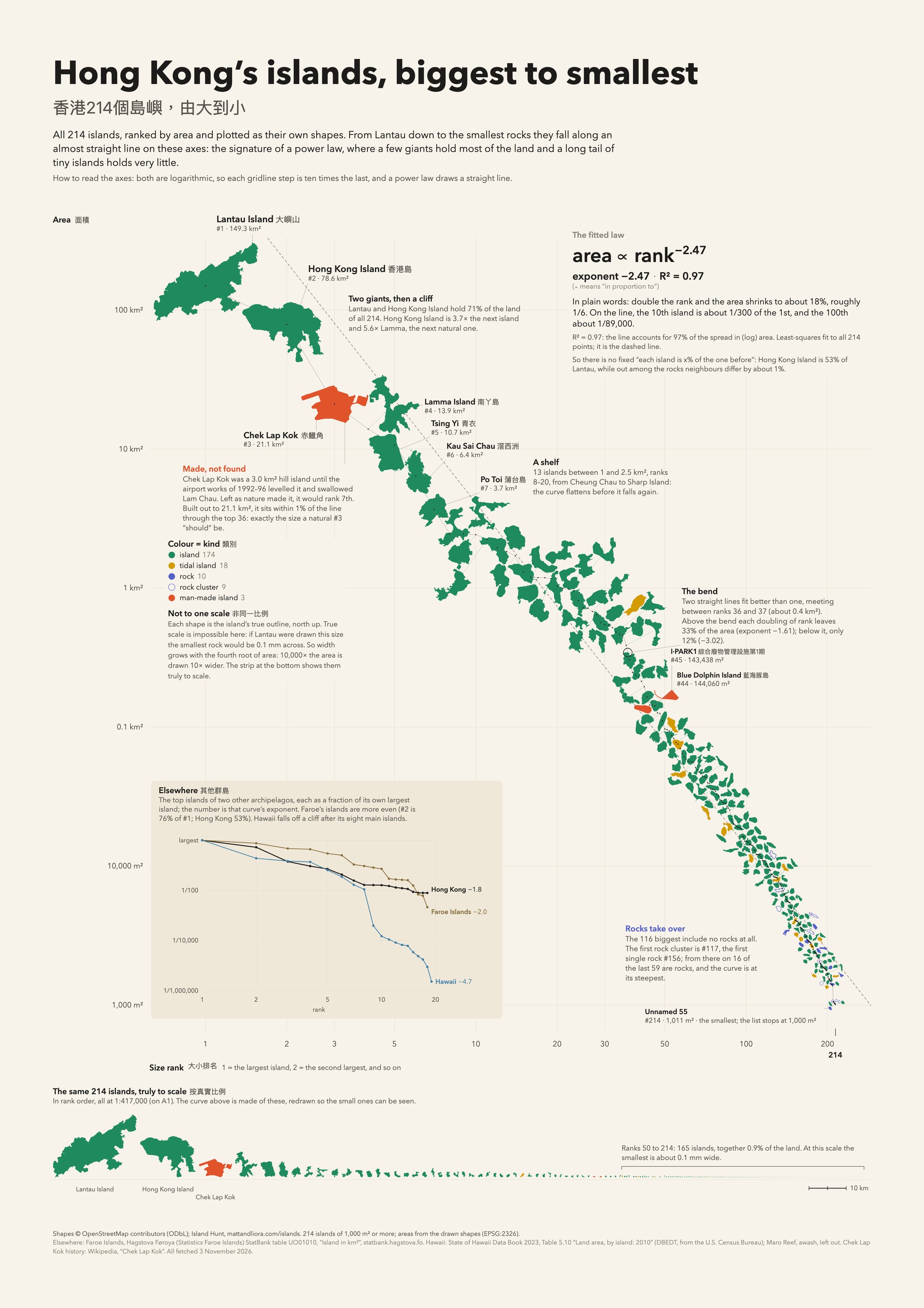
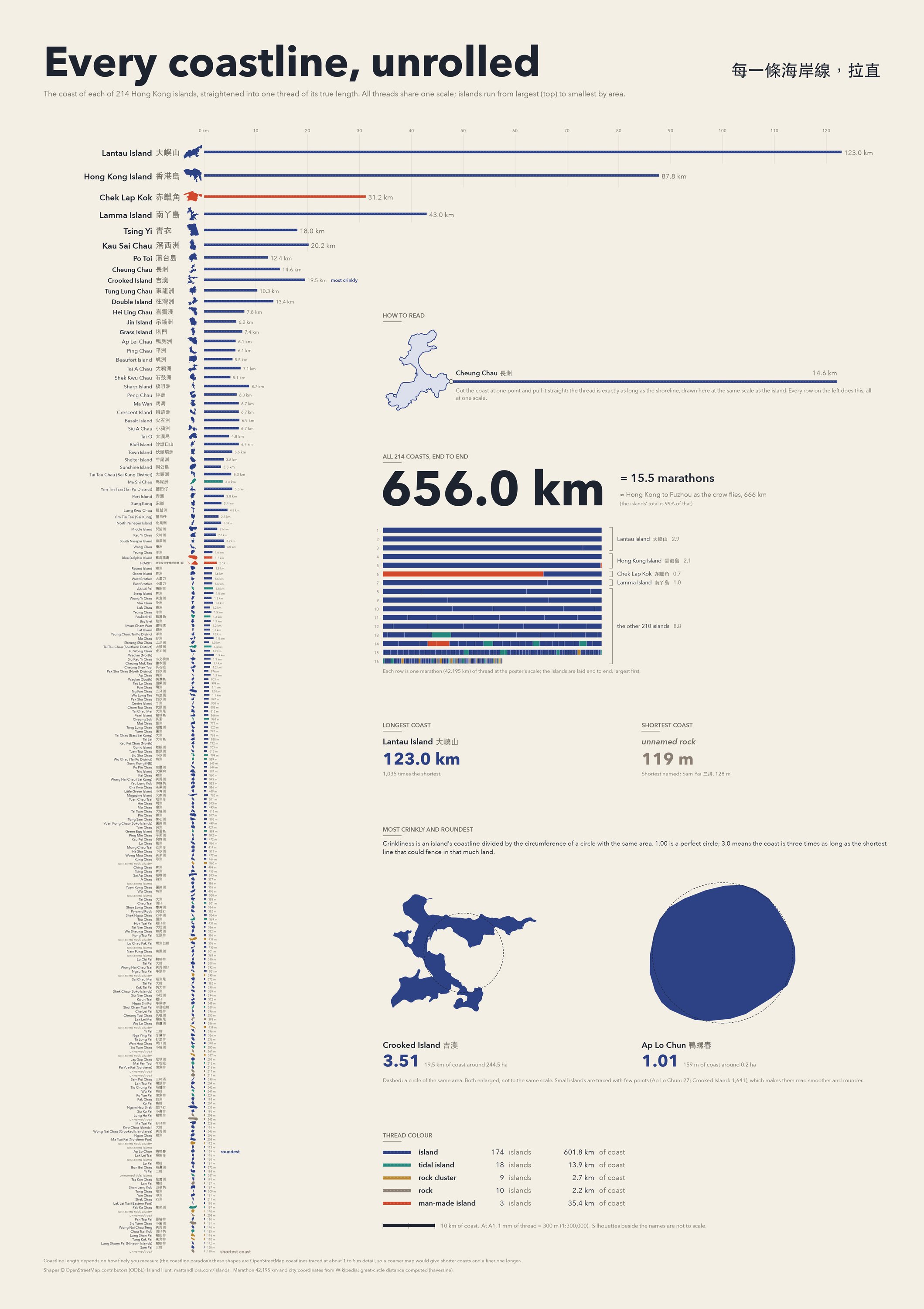
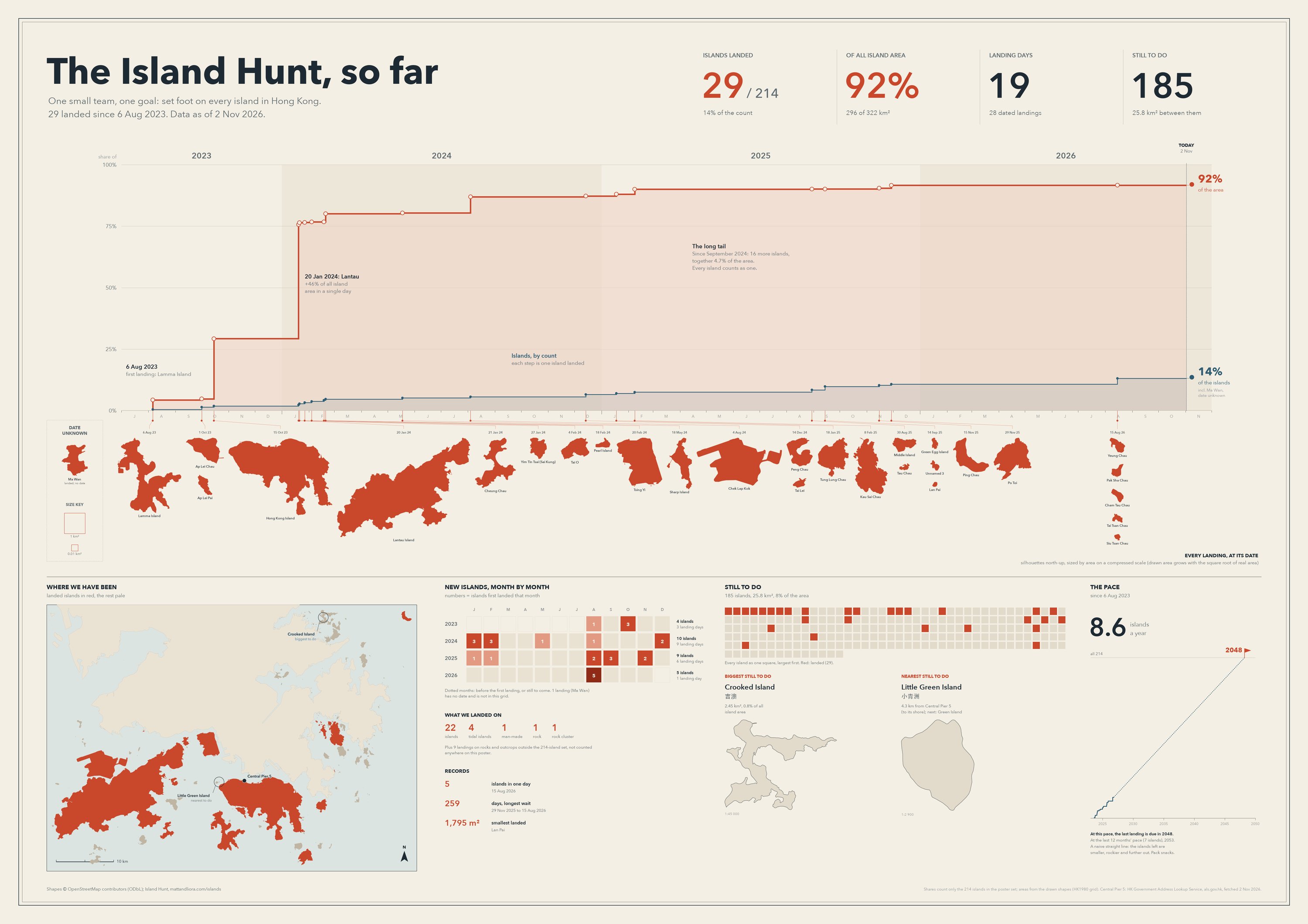
Every island in Hong KongA0 · the map, then each size class popped out of the one abovePDF · 2.3 MBA comparative viewA1 · a Victorian plate, every island at one true scalePDF · 3.8 MBUranometria InsularumA1 · the islands as a star chart; landed islands in goldPDF · 8.8 MBThe periodic tableA0 · sea areas as groups, size classes as periodsPDF · 1.4 MBHow far is every island?A1 · true bearing and distance from Central Ferry PiersPDF · 0.3 MBThe rank-size curveA1 · the islands themselves drawing a power lawPDF · 0.9 MBEvery coastline, unrolledA1 · each coast pulled straight, at one scalePDF · 0.8 MBThe Island Hunt, so farA1 · every landing on a timeline, and the pace to finishPDF · 0.6 MB